Doesn’t the National Forest already protect the Red River Gorge?
Yes and no. Many people have this question, and the confusion is understandable. Many visitors know the Red River Gorge as the many wonderful official Forest Service trails and land, which are indeed protected by the U.S Forest Service.
However, there are significant portions of private land in the Red River Gorge area at risk of commercial development, which in many cases cause harm to the fragile ecosystems and sandstone cliffs. We’re working to protect these areas through our land trust and conservation easements.
So what is the Red River Gorge? Where is Red River Gorge United working?
Red
River
Gorge
Geological
Area
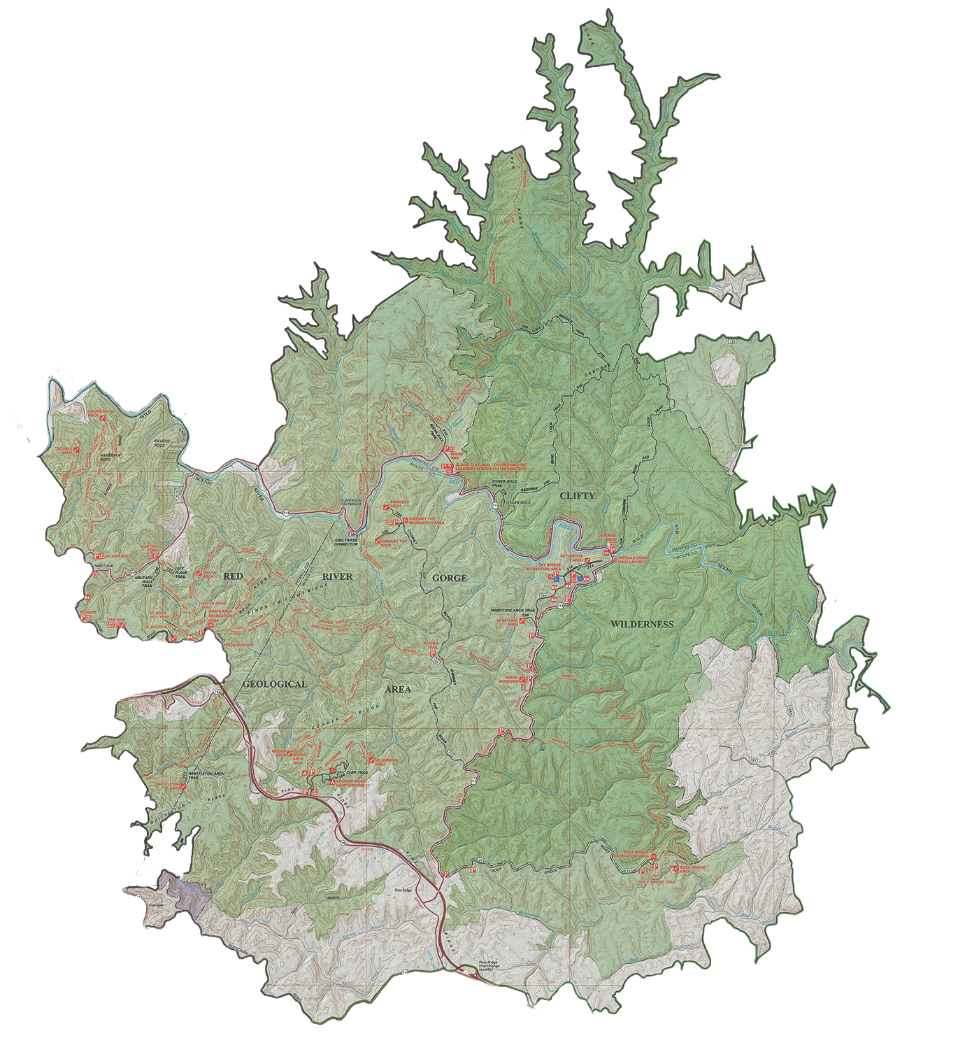
Red RIver Gorge
There are some records of early settlers referring to the Red River, but no one knows who coined the term “Red River Gorge,” or when it came into common use.
The first official use of the term was in 1937, when the designation of “Red River Gorge Geological Area” was applied to a section of the Daniel Boone National Forest. This demarcated 37,217-acre of land within these boundaries 29,116 acres of which are federally owned, while 8101 acres are privately owned.
The map illustrates this boundary line, which is the border of the map. The green shaded areas represent federally owned land, while the white areas represent private property.
What’s Special about it?
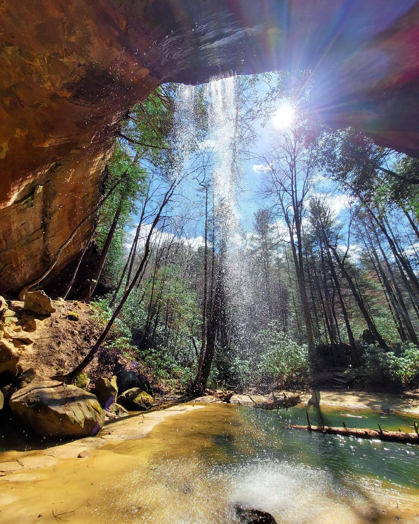
Geologically speaking, The Red River Gorge contains the largest concentration of arches east of the Mississippi River. Along with arches are hundreds of miles of sandstone cliff lines. These rugged cliffs and delicate arches were formed by the unique geological conditions of the Pottsville escarpment which sits on the edge of the Cumberland Plateau.
Biologically speaking, the conditions of the Red River Gorge give rise to incredible flora and fauna, some found nowhere else in the world. The White-haired goldenrod (Solidago albopilosa) is one such example.
Red River Gorge’s position geographically means that many northern and southern species co-exist here at their respective ranges, resulting in a remarkable diversity of species.
The FIve-COuntY Region
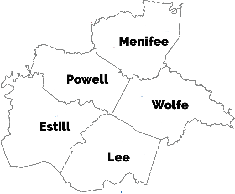
Since the designation of the “Red River Gorge Geological Area” in 1937, the term “Red River Gorge has come to refer to a wider region beyond the boundaries of the original “Geological Area.” Many cliffs and arches in the Pottsville escarpment beyond these boundaries. In fact, most of the rock climbing, a sport the Red River Gorge is world famous for, lies outside of these demarcating lines.
We have decided to work in a five-county region of what is now known as the Red River Gorge. We prioritize land in and around the geological area, but also recognize the enduring value of the same geology and ecological diversity found in these surrounding five counties.